National Museum of the Great Lakes Entrance
A long time ago—a very long time ago—I got to stroll the decks of a Great Lakes bulk freighters. When I was in elementary school, my father had connections with the crews aboard some of these vessels. If they happened to load or unload at the docks near the mouth of the Maumee River in Toledo, Ohio, he’d sometimes take me along when he went to see his friends. At other times when a newly christened lake freighter visited the port, there was a celebration and the freighter would be opened to the public. It was on one of these occasions that I toured the ill-fated Edmond Fitzgerald—now that was a long freighter, over 700 ft. in length. Surprisingly, I never went aboard a bulk freighter during my military career, though I was on active duty in the US Coast Guard and stationed on the Great Lakes. Instead I spent my enlistment Inspecting cargoes carried aboard sea going vessels, pulling drunken yachtsmen out of the lake, maintaining generators and electrical systems aboard the USGC Cutter Mackinaw, and setting buoys and fueling remote light stations from various black & tan USCG buoy tenders.
Recently I visited Toledo and the new National Museum of the Great Lakes—a fabulous, ultramodern museum full of information and interactive exhibits. But the exposition spéciale is the Great Lakes bulk freighter Col. James M. Schoonmaker.

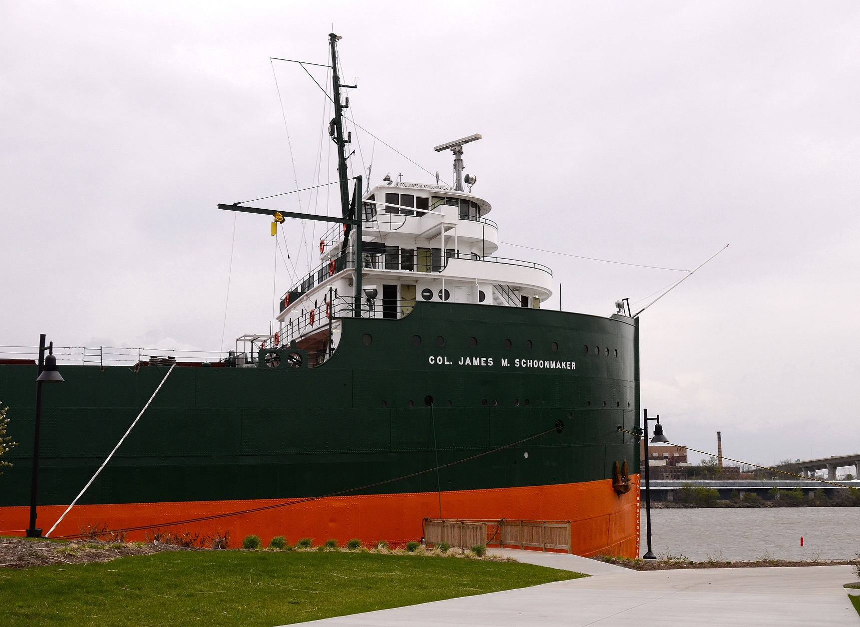
Bulk Lake Freighter Col. James M. Schoomaker
The J.M. Schoonmaker is 617 ft. in length, with a 64 ft. beam, 33 ft. one inch from the main deck to the keel, weighing 8,600 tons empty (23,600 tons loaded) and launched over 100 yrs. ago on July 1, 1911. Powered by a pair of steam turbines, she plied the lakes for over 65 years. At the time of her launch, she was considered the “Queen of the Lakes,” the largest bulk freighter in the world.

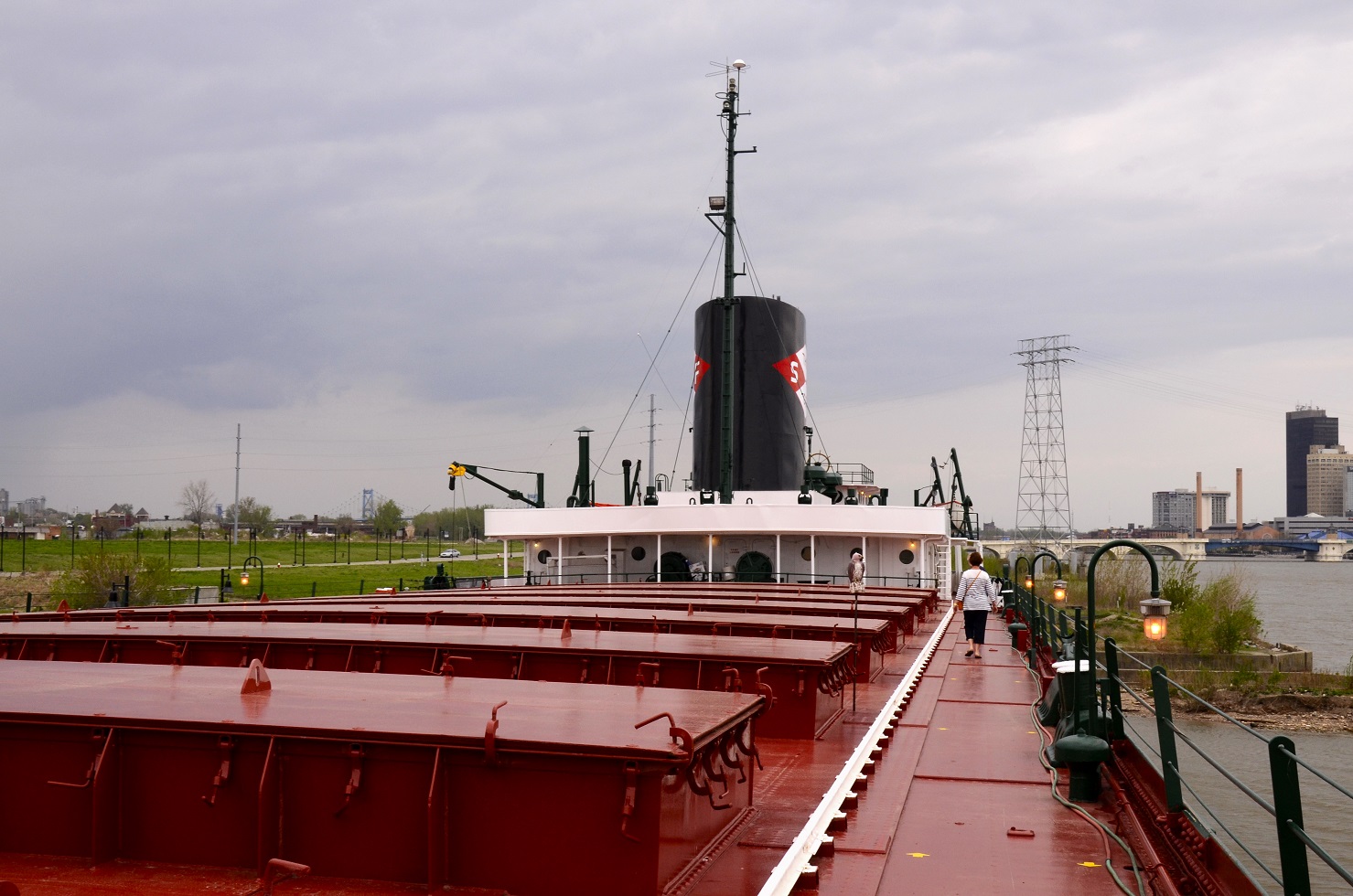
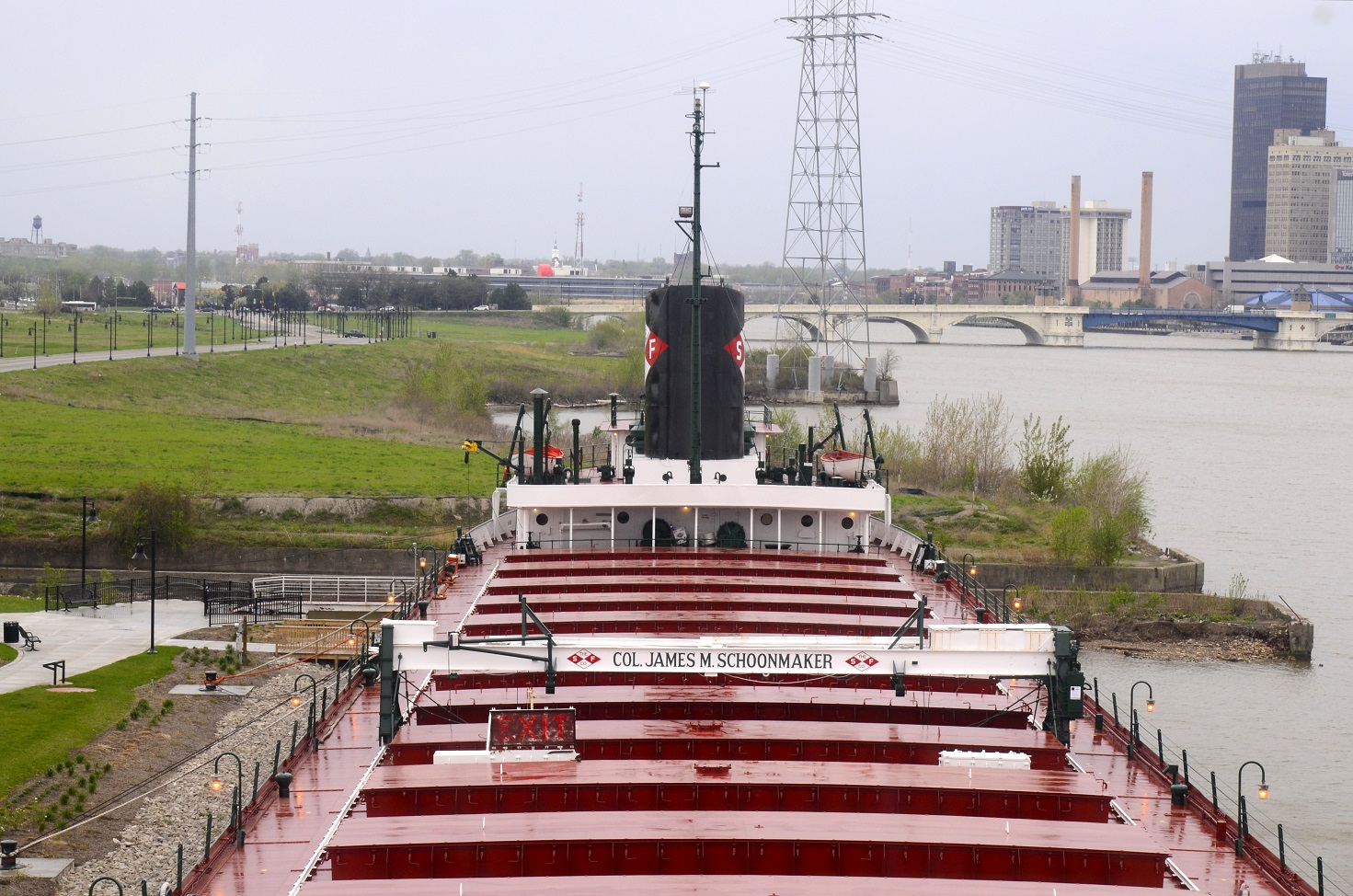
Strolling Aft
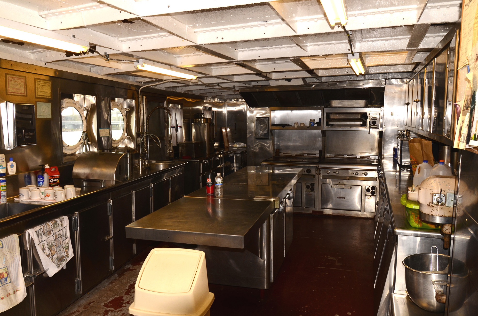
For a self-guided tour of the Schoonmaker, we boarded her in a light rain forward of amidships. With the threat of a stronger storm approaching, we gingerly made along the slick deck to the cover of the vessel’s stern-house. This rear structure houses the ship’s galley, crews’ mess, officers’ dining room, and cooks’, crews’, stewards’ and engineers’ cabins. Two decks below is the engine room, a space extending from under the main deck to the floor covering the bilges. A mezzanine-styled deck midway down divides the engine room. This deck houses the generators and electrical distribution panels.

Crews’ Galley
While touring the engine room, we knew when the strong storm hit. The hawsers, holding the freighter against the dock, creaked and groaned as they strained against the wind.

Engine Room. Photo by Marian L. Lewis

High Pressure Turbine Statistics
Back outside on the main deck after the storm had passed, we carefully walked the length of about two football fields to the bow. Along the way are the battened cargo holds, a cargo hatch crane, several deck winches, and the landing boom (a sling that lowers a seaman to the dock or pier to secure the ship’s hawsers when the vessel ties to shore). Our destination was the three-storied superstructure that rises above the main deck and contains the passenger hall, lounge, grill room, owner’s cabin (main deck), captain’s cabin and office (second deck), flying side decks, and the pilot house (bridge).

Looking Forward (toward the bow) from Amidships
After a very wet and windy climb up the ladders we found that the bridge hatches were closed. I threw up my arms in disappointment, but then I spotted a docent inside, a rugged looking fellow. He waved a greeting and motioned us to a leeside hatch, which he opened. “Had to close the doors to avoid the hurricane force winds that storm produced,” he said.

Looking Aft from Bridge Deck
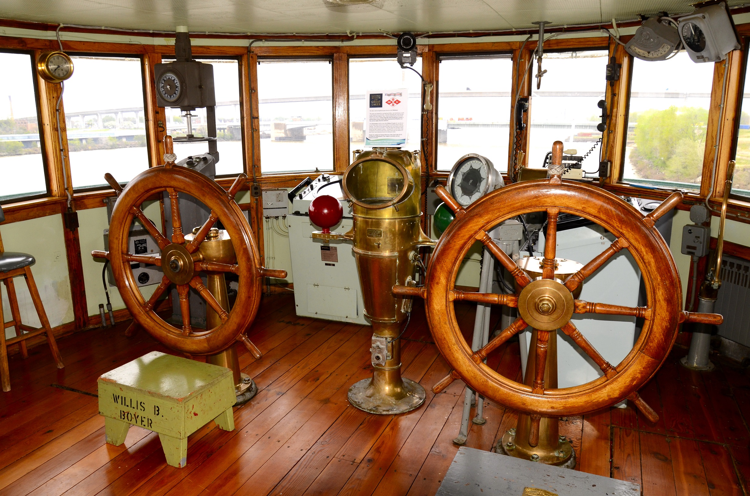
Stepping into the pilot house, I found an uncluttered space and, as suspected, a lack of modern navigational equipment. Aboard the research vessels I had previously worked on, the pilot houses contained a helmsman’s chair behind a single wheel and a hodgepodge of computer screens, buzzing boxes, blinking colored light, and bunch of other hi-tech gadgets. This was not so on the Schoonmaker. Forward of the center, but on the midline, stood an old-fashioned binnacle, which contained the magnetic compass. In front and to its right was a gyro compass repeater. On each side of the binnacle was a large ship’s wheel. This vessel had two wheels.

Pilot House or Bridge and the various pieces of Steering and Navigation Equipment
“Always good to have backups, especially compasses and steering systems,” the docent said. “There are three other wheels aboard. A big one on the fantail for backing down and docking, and two in the engine room. In case the gyro goes, the fallback is the old magnetic compass. It always works.”
We saw the two wheels in the engine room. They were about a quarter of the size of these on the bridge. “You’d need some lookouts stationed on deck if the helmsman were steering in the engine room,” I said.
“For sure.” The docent nodded and pointed to the ship’s telegraph (bridge to engine room communication to control the action of the turbines) and the shipboard telephone.
A LORAN (LOng RAnge Navigation) system (my first duty as a Coasty was to man the LORAN transmitter at a USCG light station on Lake Erie), a radio direction finder, radar, spotlights, and the cord to blow the ship’s horn were efficiently placed forward of the wheels. Guess what? There were no computers on the bridge. Yet the Col. James M. Schoonmaker had, thought dated, all the instruments that were necessary to ply the Great Lakes.
ʃ ʃ ʃ ʃ
© Copyright 2014 by Richard Modlin
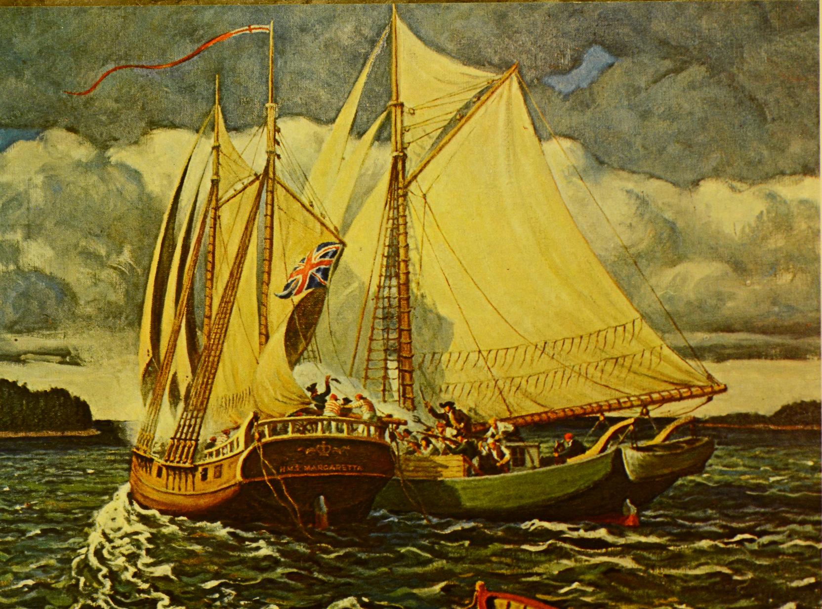
For a tale of a nautical adventure taking place at the beginning of the American Revolution please read my latest novel, Newfound Freedom. For information click above on “My Books.”